 |
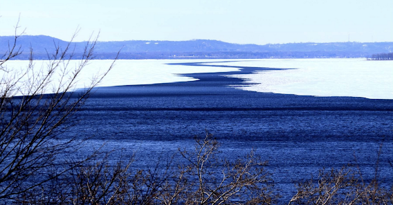
| Lake Pepin, the river's widest natural section, is part of the Minnesota–Wisconsin border. (Photo: Tom Peterson, Stateline) |
A Wikipedia snapshot on how mighty the "Mighty Mississippi" is: The river has the world's fourth-largest drainage basin ("watershed" or "catchment"). The basin covers more than 1,245,000 square miles, including all or parts of 32 U.S. states and two Canadian provinces. Wow.
Spring is here, melting ice on the Mississippi and snow in its watershed. "As state and federal officials prepare for the prospects of spring floods, last fall's drought, which stalled commercial boat traffic on the mighty river, is never far from mind," reports Tom Peterson of Stateline. "The drought provided an expensive reminder of just how vital — and how vulnerable — the economic thoroughfare is." Lou Dell'Orco, chief of operations for the Army Corps of Engineers, told Peterson, "It's a highway. If you haven't lived around it, you don't recognize it. But it's a major artery to move goods and commerce in a safe, efficient and cost-effective manner."
The river handles "92% of the nation's agricultural exports and 78% of the world's exports in feed grains and soybeans," Peterson reports. "Millions of barrels of crude oil and other petroleum products move on the river monthly, as do 35% of the nation's exports of thermal coal, which fuels power plants. . . . Eleven of the top 12 agriculture-exporting states in the nation lie in the basin. . . .When the river dropped precipitously last fall, it snarled barge traffic and delayed shipments, exacerbating supply chain problems and bringing the Mississippi River's role in the U.S. and global markets to the fore."
"What comes this spring is uncertain. The National Weather Service's spring flood forecast called the risk to the Mississippi main-stem 'well above normal,'" Peterson reports. "Since February, the service reported, at least one significant weather system has moved through the Upper Mississippi region each week, leaving an 'anomalously large snowpack.'" As of April 12, the service's website says, "Based on snowmelt alone, [they are] expecting the similar river levels that were seen in April 2019. . . . Based on snowmelt alone, we are expecting rivers to crest between April 19 to 26. Any additional precipitation may result in secondary crests or exacerbate ongoing flooding."
Olivia Dorothy, director for the Upper Mississippi Basin at American Rivers, told Peterson, "We've known for quite some time that climate change is going to be causing these pendulum swings between extreme drought and extreme floods." Peterson adds, "Ice, floods and low water made navigating the Mississippi difficult long before Mark Twain began chronicling its charms and dangers. The dangers are expected to become more frequent."
No comments:
Post a Comment