Showing posts with label census. Show all posts

Tuesday, May 05, 2026

Virginia's coalfields are losing residents at an alarming rate

The population in Virginia’s coalfield's region is dropping at an alarming rate, with Buchanan County down 51% from its peak in 1980, writes Jim Branscome at Cardinal News, which covers Southwest Virginia.

Virginia’s seven Central Appalachian coalfield counties collectively lost 7,208 residents between 2020 and 2025, according to the U.S. Census Bureau.

Buchanan County had the biggest five-year loss of them all at 9.1%, among the worst in the entire 60-county Central Appalachian area, Branscome adds.

Buchanan County had the largest five-year change in population of the seven Virginia coalfield counties. (Chart via Cardinal News, data from the U.S. Census Bureau, Click to enlarge)

The two main factors working together to create the alarming trajectory for Virginia’s coalfields are people leaving the region and the number of deaths exceeding the birth rates, Branscome writes. 

The median age in Buchanan County has almost doubled since 1980, from 26 to 47, Branscome reports. While the county is projected to lose 48% of its current population by 2050, its current annual rate of decline shows this loss occurring closer to the late 2030s, adds Branscome.

Friday, October 18, 2024

Younger people left metro areas for smaller cities during the Covid era, and many aren't going back 'anytime soon'

University of Virginia graph, from Census Bureau Annual
Age Estimates
The population of some bigger U.S. cities is shrinking as younger residents move to smaller towns and cities even as Covid-era worries wither, reports Paul Davidson of USA Today. "Since the pandemic, cities with more than 1 million residents have lost adults ages 25 to 44 while towns with smaller populations have gained young people, after accounting for both those moving in and leaving, according to a University of Virginia analysis of Census Bureau data."

Hamilton Lombard, the study's author and a demographer at the University of Virginia’s Weldon Cooper Center for Public Service, told Davidson, "Younger adults have driven most of the shift. . . since the pandemic. . . . The migration of younger adults into small towns and rural areas picked up last year rather than returning to pre-pandemic trends."

The age group's surprising shift in geography and lifestyle preferences has some experts scratching their heads. "The migration of young adults to small towns unexpectedly accelerated last year. From 2020 to 2023, young people comprised 54% of population gains in areas with fewer than 250,000 residents," Davidson reports. "Since 2020, areas with fewer than 1 million residents have added 25- to 34-year-olds in large numbers while more densely populated areas have lost them."

"Those in the 25 to 44 age bracket may not come back to large metro areas anytime soon," Davidson reports. Remote work options have "allowed more young Americans to live in smaller towns with more open spaces, natural beauty and low costs. . . . As large-city home prices and rents have soared, young people have flocked to smaller, more affordable markets."

Tuesday, July 18, 2023

Ruralites have higher rates of disability, especially in South

Data includes civilian non-institutionalized population.
(Map by Katrina Crankshaw, from Census Bureau data; click it to enlarge)

Rural residents have higher rates of disability than their urban counterparts, with the South having the highest regional rate. The reasons could include older populations and limited access to medical care, reports Katrina Crankshaw for the Census Bureau's Health and Disability Statistics Branch. 

Crankshaw overlooks another possible reason. Education levels tend to be lower in rural areas, which makes it easier for injured manual laborers without high-school diplomas to win disability benefits.

Crankshaw reports rural residents "were more likely (14.7%) than their urban counterparts (12.6%) to experience disability. . . . The South had the nation's highest rates of disability (13.8%), followed by the Midwest (13.1%), the Northeast (12.3%), and the West (12.1%) . . . according to the American Community Survey 1-year estimates." The ACS is the bureau's ongoing poll of the U.S. population.

Reporting distinctions can help government and community planners learn what services residents need and where especially when it comes to rural medical care or broadband access. "It is important to understand how regional and urban/rural differences in disability contribute to the unique challenge of addressing health disparities in the United States," Crankshaw adds. "Identifying where people with disabilities are concentrated can help inform where there may be shortages of specialized providers or limited transportation options."

Dan Kessler, interim executive director of the Association of Programs for Rural Independent Living, told Kristi Eaton of The Daily Yonder, that one reason could be health-care accress: "Looking at primary care, where you may see a physician for several issues, for example, your diabetes or some other condition, which, if left untreated, could very well result in someone acquiring a long-term disability." Eaton writes, "Kessler added that the digital divide also impacts access to medical care," making telehealth impossible and online scheduling for appointments or transportation more difficult.

Crankshaw notes, "Many states in the South are part of what is known as the Stroke Belt, defined by the National Heart Lung and Blood Institute as a cluster of states (including Alabama, Arkansas, Georgia, Indiana, Kentucky, Louisiana, Mississippi, North Carolina, South Carolina, Tennessee and Virginia) that have a higher incidence of stroke than the rest of the country. . . . . Stroke is one of the nation's primary causes of long-term disability, and half of stroke survivors age 65 years and older experience reduced mobility as a result. The higher stroke incidence is just one factor that may contribute to the southern region's overall higher disability rates."

What constitutes a disability? Crankshaw explains, "ACS considers people to have a disability if they have difficulty with one or more of the following: Seeing, hearing, concentrating or remembering (age 5 and older), walking or climbing stairs (5 and older); dressing or bathing (5 and older); doing errands alone, such as buying groceries or going to the doctor (15 and older).

Friday, April 07, 2023

Some places will shift from rural to metropolitan this year, and that will likely make the rest of rural America look worse

Screenshot of part of Daily Yonder interactive map that
shows major growth in rural counties near metro areas
in Texas, Oklahoma, southwest Missouri, Tennessee,
Georgia and elsewhere. (Rural Blog adaptation)
"Rural" is defined in many ways, and because one major definer is changing its definition, "Some of the nation's most economically successful 'rural' counties will be reclassified as metropolitan, moving their populations and economic output from non-metropolitan to metropolitan," writes Saran Melotte of The Daily Yonder. "This year, the Office of Management and Budget will create a major revision for its list of metropolitan statistical areas based on 2020 Census data. . . . It’s one of the most common ways that policy makers, federal agencies, and researchers use to define what we mean by 'rural'."

MSAs are defined by a combination of population figures and commuting patterns. The 2020 census found that the rural counties that were growing were thsoe closest to metropolitan areas, and some of them have likely grown so much that they will be reclassified as metropolitan. In the last reclassification, in 2013, "OMB shifted 112 non-metropolitan counties into the metropolitan column, moving 5.7 million residents into metro areas," Melotte notes. Their counties either gained enough population to have a central city of at least 50,000, or the share of the county's workers "who commuted to an adjoining metropolitan county grew past 25%. The latter factor is "more commonly the cause of reclassification," according to Daniel T. Lichter of Cornell University and Kenneth M. Johnson of the University of New Hampshire. They call this the paradox of rural population decline and say it "gives a falsely bleak impression of rural America," Melotte writes.

"You might think you know rural when you see it. But what if you had to provide a clear definition?" Melote asks. "That's where things get messy. Even geographers, demographers, and statisticians can't agree on a single definition of rural. Depending on which definition you use, rural Americans either comprise 46 million residents or over 60 million residents. Rural populations are either growing or stagnating, economically vibrant or persistently poor, predominantly white or rapidly diversifying. . . . Demographers stress the importance of considering how our definitions might obscure the truth about rural America. . . ."When counties that have large rural populations are lumped into the metropolitan category, it can make rural America look poorer and smaller than it really is."

Melotte notes, "Federal agencies use over a dozen definitions of rural. But at their core, those definitions are generally variations on two categorization systems," the MSA or the Bureau of the Census definition, which recently raised the threshold for an urban place from 2,500 to 5,000 or 2,000 housing units.

Tuesday, January 03, 2023

'Urban' now requires 5,000 people or 2,000 housing units; losing 'rural' designation could help some towns, hurt others

Gravette, Ark., pop. 3,547, was urban and is now rural.
(File photo by the Arkansas Democrat-Gazette)
About 1,100 U.S. towns with 4.2 million residents are now classified as rural, not urban, because the Bureau of the Census has changed the criteria it uses to make those distinctions, as it does after each census. This change is the biggest since 1910, reports Mike Schneider of The Associated Press

"The new criteria raised the population threshold from 2,500 to 5,000 people and housing units were added to the definition," Schneider reports. "The change matters because rural and urban areas often qualify for different types of federal funding for transportation, housing, health care, education and agriculture,"The federal government doesn’t have a standard definition of urban or rural, but the Census Bureau’s definition often provides a baseline."

Mary Craigle, chief of Montana’s Research and Information Services Bureau, told AP, “Places that qualify as urban are eligible for transportation dollars that rural areas aren’t, and then rural areas are eligible for dollars that urban areas are not.”

The change reflects the reduced economic vitality and diversity of small towns. North Carolina State Demographer Michael Cline told AP that in 1910, a town with 2,500 people had many more goods and services than a typical town that size today, “and these new definitions acknowledge that.”

The Census Bureau had proposed raising the urban threshold to 10,000 but retreated in the face of opposition. The 5,000 threshold means that slightly, to 79.6% of the U.S. population is urban and 20.4% is rural. Under the old criterion, almost 81% was urban, Schneider reports.

UPDATE, Jan. 6: The bureau told Josh Zumbrun of The Wall Street Journal that its old 2,500 threshold was “the lowest in use among all federal agencies. We see the change in our minimum threshold as signifying that the Census Bureau is listening to stakeholders and feedback from other agencies and is matching the way others have characterized and classified settlement in the United States.” Zumbrun concluded, "The official rural population count has long been held down by an arbitrary definition. The country is more rural and small-town than we think."

This is the first time the bureau has used housing units to define urban areas. "A place can be considered urban if it has at least 2,000 housing units, based on the calculation that the average household has 2.5 people," Schneider reports. "Among the beneficiaries of using housing instead of people are resort towns in ski or beach destinations, or other places with lots of vacation homes, since they can qualify as urban based on the number of homes instead of full-time residents."

Tuesday, December 06, 2022

Rural America grew last year for the first time in a decade, even more so than metropolitan areas, but future uncertain

Carsey Institute graph from census data
After 10 years of population decline, rural America is growing again. That's what the newest analysis of census data from Carsey School of Public Policy at the University of New Hampshire is indicating.

"Recent research suggests that the turbulent economic, social, and epidemiological conditions of recent years altered traditional demographic trends in non-metropolitan America," writes Kenneth Johnson, professor of sociology and senior demographer at Carsey.

The decade prior to 2020 was noted by rural depopulation, as many people left rural areas in favor of more urban living and rural areas had more deaths than births. "Yet, the latest Census Bureau population estimates document renewed population gains in nonmetropolitan America between April 2020 and July 2021," Johnson writes. "In fact, the rural population gain exceeded that in metropolitan areas, something that is rare in American history." Johnson explains that the number of people moving into rural areas exceeded the "growing excess of deaths over births fostered by Covid-19."

Johnson reports some migration to rural areas was seen in "high amenity recreational and retirement areas because net migration gains to these counties accelerated early in the pandemic." While some rural areas continue to see declines, many counties still saw gains "but a sizable number of counties had population increases" because more people moved into areas than died from Covid 19.

To survive, rural counties need continued, sustained migration. Johnson writes, "only sustained net migration gains can provide the demographic lifeline these communities need to stave off depopulation. Whether these nonmetropolitan migration gains will continue in this turbulent era remains to be seen."

Friday, October 07, 2022

The town at the center of U.S. population, with 613 souls, increasingly faces same challenges as many small towns

When the results of the latest census were analyzed, Hartville, Mo., gained a plaque but still faced a declining population, reports Joe Barrett for The Wall Street Journal. The census showed that the town of about 600 was the one closest to the U.S. population center — the point at which "an imaginary, flat, weightless and rigid map of the United States would balance perfectly if all residents were of identical weight," the Census Bureau says. 

Hartville, Mo. (Wikipedia)
The plaque was a needed plus. Hartville Mayor Rob Tucker told Barrett that the town has lost about 100 people over the past 15 years. The town was "bypassed by railroads and later highways, leaving its economy stymied. A Lee jeans factory, one of the last major employers, pulled up stakes decades ago," Barrett reports. Nearly a third of residents live below the poverty line. 

Since the nation's first census, the U.S. population center has trended west and south over time. The town clerk of Plato, Mo., the previous population center, told Barrett that the distinction brings in occasional visitors but not much money. 

Still residents take pride in Hartville, opening new business ventures that aim to enliven the town square. A local nonprofit, the Community Betterment Foundation, is working to transition a shuttered Subway restaurant into a local cafe, while a local couple hopes to open an alcohol-free gathering place for young people just a few blocks away, Barrett reports.

Wednesday, August 17, 2022

Census says in the most rural areas it missed over 4% of housing units, mainly trailers and single-occupancy rentals

Screenshot of Census Bureau map shows the most rural tracts in yellow and light green.
For a larger version of the map, click on it; for the original map on the Census Bureau site, click here.

The 2020 census missed about 1 in 25 housing units in the most rural areas of the country, and 1 in 20 on Native American reservations, says the Census Bureau's latest report on the decennial count.

"Experts have said census miscounts will impact the distribution of the more than $1.5 trillion federal funds annually based at least in part on census results," reports Michael Macagnione of Roll Call. "Tuesday’s report analyzed census results based on the type of housing units counted and showed the census as largely accurate for owner-occupied housing as well as small multi-unit buildings, but the census missed those living in trailers and rural areas." The mobile-home undercount was 4.3%; for the most rural census tracts (not including "Remote Alaska") it was 4.2%.

While most of the country is counted through self response, the most rural areas without regular mail access or reliable internet access were counted through a different process. There, census workers went to individual households to drop off census forms or count residents themselves, but missed about 4 percent of the housing units."

Those results come from the bureau's post-enumeration survey, questionnaires sent to a random sample of households. The bureau explains that it accounts for housing units in a "slightly different" way than it counts population: "The key difference is that the Census Bureau works throughout the decade to build a list of all the housing units in the nation. This address list, called the Master Address File, is then used to invite people living at those addresses to respond to the census and to follow up with them if they do not. The list is also used to ensure the population is tabulated to the right location. This means that housing-unit coverage relies more on an accurate address list than on obtaining responses required for counting people."

The report said the census overcounted housing units in Alabama, Massachusetts, New Jersey, New York, Ohio, Rhode Island, and Utah. An earlier report estimated that there were undercounts of population in Arkansas, Florida, Illinois, Mississippi, Tennessee and Texas, and overcounts in New York, Ohio, Rhode Island and Utah. This is the first report on rural undercounts.

Thursday, June 16, 2022

Sign up for USDA's Census of Agriculture by June 30

Want to stand up and be counted in the U.S. Department of Agriculture's Census of Agriculture? You have until June 30 to sign up. You will need to sign up if you didn't participate in the 2017 Ag Census and you don't get other USDA surveys or censuses. Click here to sign up or for more information.

USDA's National Agricultural Statistics Service holds the Ag Census every five years to provide as complete a count as possible of U.S. farms and ranches and the people who operate them. This year will feature a new web portal meant to make participation easier. Producers who sign up in time can complete the survey securely online in November (NASS will mail out access codes then). In addition, NASS will mail out hard copies of the survey in December.

The survey has been conducted for more than 180 years, and remains the only source of comprehensive and impartial agricultural data for every state and county.

Friday, May 20, 2022

Trump administration's efforts to tilt the census may have cost states that voted for him seats in the U.S. House

"The Trump administration spent an extraordinary amount of time and effort messing with the census over four years. Its apparent aim: It wanted to exclude undocumented immigrants from population counts, thereby allowing Republicans to draw more favorable maps in redistricting and gain more ground in the House," Aaron Blake writes for The Washington Post. "The effort ultimately failed. And it now seems possible that these efforts might have played a role in costing red states seats." 

According to a new Census Bureau report, the census significantly miscounted 14 states; in six, the counts are estimated to be off by 4 percentage points or more. "A trend you might notice if you peruse the data is that most of the states with significant overcounts were blue states like Hawaii (e.g., Delaware, Rhode Island, New York and Massachusetts), while most with undercounts were red, Southern states like Arkansas (e.g., Tennessee, Florida, Mississippi and Texas)," Blake notes.

That means that red states might not have received as many U.S. House seats as they should have during reapportionment, while blue states might have received more. So many factors are in play that it's difficult to estimate the exact impact of the miscounting, but it seems clear that blue-leaning states Minnesota and Rhode Island got to keep seats they should have lost, and red-leaning states Florida and Texas didn't get seats they should have gotten, Blake writes.

Blake notes that pandemic chaos could have contributed to the miscounts, as well as the fact that some undercounted states didn't do as much to encourage people to complete the census. He also notes that "adding a seat to a blue state doesn’t necessarily translate to a blue seat. That depends on how the maps are drawn in a particular state, given the distribution of population. The red-state undercounts mean those states could be deprived of billions of dollars in federal funding over the next decade, since much funding is calculated based on population counts, Reid Wilson reports for The Hill.

Monday, May 02, 2022

More than 1,300 small urban areas will be classified rural under new Census criteria; could affect federal funding

More than 1,300 urban areas will be reclassified as rural under the Census Bureau's new criteria; some worry rural areas could get less federal funding. "A revised list of urban areas won’t be released until later this year, but a third of the areas deemed urban a decade ago would be knocked into the rural category under the new criteria," reports Mike Schneider of The Associated Press.

The biggest change is that the bureau will count housing units instead of people to define urbanity and rurality. Under the old definition, a place with at 2,500 or more residents was considered urban, but many people considered that number, in use for more than a century, too low. Now, urban areas will be those with at least 2,000 housing units, which translates to a population of about 5,000.

"Some communities worry that the switch to housing units will cause some areas to be underestimated if the Census Bureau uses the U.S. average of 2.6 people per household for its calculations," Schneider reports. "A coalition of associations representing cities, counties, planners and transportation groups had objected to many of the proposed changes last year, saying the switch from people to housing units would miss variations in development and land-use patterns.

"The Census Bureau tried to address those concerns by creating three levels of urban-area definitions for census blocks, which are the nation’s smallest geographic unit and show rural areas inside counties that are part of metropolitan areas largely because of commuting patterns. Census blocks will be urban if they have 425 housing units per square mile, the equivalent of 1,105 people. Before the change, census blocks with at least 500 people per square mile were considered urban. The redesignation gives the bureau a way to distinguish between the 'urban nucleus' and less densely populated areas, typically on the fringes of urban areas."

Some stakeholders worry that rural areas could lose federal funding for health care, education, infrastructure and more. Though the bureau warns that the new criteria should be used for statistical purposes only, other federal agencies routinely use its classification system to determine who qualifies for funding, Schneider reports. So more rural areas means blanket funding would have to stretch further, and competition could increase for grants.

Tuesday, April 26, 2022

Friday webinar will discuss the accuracy of the 2020 census, an issue in many rural areas, and how to best use its data

The National Conference of State Legislatures will host a free webinar at 2 p.m. ET Friday, April 29 to discuss how stakeholders can best use data from the 2020 census and to discuss its accuracy, which has implications for many rural areas.

From the website: "With the 2020 census results out, many are eager to use the data—and to assess its accuracy. The U.S. Census Bureau has begun releasing its own data-quality evaluations, with national results from the 2020 Post-Enumeration Survey and the 2020 Demographic Analysis estimates. Data users outside the bureau are looking at quality, too. In this webinar, we’ll discuss this decade’s census data quality and how it compares with that of previous decades, what additional analyses are coming from inside and outside the bureau, and what questions remain."

Wendy Underhill, NCSL's director of the elections and redistricting program, will moderate a panel of speakers that will include:
  • Tim Kennel, assistant division chief for statistical methods, Census Bureau
  • Teresa Sullivan, chair, National Academies of Sciences, Engineering and Medicine’s Panel to Evaluate the Quality of the 2020 Census
  • Dr. William O'Hare, president, O'Hare Data and Demographic Services LLC
Click here for more information or to register.

Monday, April 18, 2022

Ex-census overseer: Skewed 2020 census meant 6 states wrongly lost a House seat, 6 more rural states gained one

The 2020 census was underfunded, understaffed, and cut short. This apparently affected some rural areas, but widespread undercounts of Blacks and Hispanics and overcounts of whites and Asians caused a malapportionment of U.S. House seats that benefited more rural states, Robert Shapiro writes for The Washington Monthly. Shapiro oversaw the 2000 census as President Clinton's commerce undersecretary for economic affairs, and chairs the economic policy think tank Sonecon.

"The large-scale errors in the census cost New York, Texas, Florida, Arizona, California, and New Jersey one seat each, and resulted in an extra representative for Minnesota, Pennsylvania, Oregon, Montana, Wisconsin, and Indiana," Shapiro writes. "Those wide-ranging errors are matters of public record, because the professionals at the Census Bureau obligingly report the decennial census undercount and overcount rates by race and ethnicity. Compared to 2010, undercounts in 2020 jumped from 2.06 to 3.3 percent for Blacks, from 1.54% to 4.99% for Hispanics, and from 0.15% to 0.91% for Native Americans on reservations and Alaskan Natives. Overcounts also shot up, increasing from 0.83% to 1.64% for whites and from virtually zero to 2.62% for Asians." Shapiro's crew calculated the effect on apportionment by applying the error rates to each state's racial and ethnic makeup.

"The debasement of the 2020 census did not have clear partisan effects. The more diverse states that lost out—states in which Black and Hispanic people account for between 33 percent and 52 percent of the population—include not only blue New York, California, and New Jersey but also red Texas and Florida and purple Arizona," Shapiro writes. "Similarly, the unwitting winners include not only red Montana and Indiana but also blue Minnesota and Oregon and purple Pennsylvania and Wisconsin—all states with populations that are 80 to 87 percent white and Asian."

Shapiro says the Trump administration didn't skew the census by overtly manipulating the results but by simply making it easier for serious errors to occur.

Thursday, April 14, 2022

Census data show an exodus from big cities in 2020-21; pandemic, living cost, remote work, politics all played roles

Net domestic migration per 1,000 residents from July 1, 2020 to June 30, 2021
Business Insider map using Census Bureau data; click the image to enlarge it or click here for the interactive version.

Newly released Census Bureau data show a mass exodus from the largest U.S. cities in the year that ended June 30, 2021. "At the same time, smaller metro areas, as a group, experienced higher population growth than in each of the previous two years, while non-metropolitan America showed the greatest annual population gain in more than a decade," William H. Frey reports for Brookings Institution. "The demographic shifts revealed by the latest census population estimates are not just a continuation of past trends. The sharp domestic out-migration from the nation’s major metro areas and urban core counties in the 2020-21 pandemic year was unusually large, even when compared with the previous year and the modest growth declines in the last half of the 2010s. As a result of out-migration from these areas, many smaller metro areas and rural counties experienced higher growth than in previous years."

Americans' reasons for moving during the pandemic varied, and it was often a combination of factors; some wanted to take advantage of remote work opportunities and get out of crowded, expensive cities they perceived as more vulnerable to the coronavirus, and some felt the pandemic was a wake-up call to pursue a slower, more meaningful life, Madison Hoff reports for Business Insider.

Politics may have motivated some to move. "America is growing more geographically polarized — red ZIP codes are getting redder and blue ZIP codes are becoming bluer. People appear to be sorting," John Burnett reports for NPR. "Residents have been fleeing states like California with high taxes, expensive real estate and school mask mandates and heading to conservative strongholds like Idaho, Tennessee and Texas." Bill Bishop first spotlighted this trend in his 2008 book The Big Sort: Why the Clustering of Like-minded America is Tearing Us Apart.

Tuesday, April 05, 2022

Many communities — disproportionately rural — say 2020 census undercounted them, and are seeking recounts

"Two years after census 2020, many cities and states say the count wildly underestimated their residents, costing them significant federal and state money for the social services and infrastructure their areas need. The numbers also have created confusion in drawing new voting districts, potentially leaving some areas with less political power than they should have in state legislatures and Congress," Tim Henderson reports for Stateline.

The issue disproportionately affects rural counties and communities that are already often at a disadvantage in drawing state and federal funding. The pandemic may have skewed response rates overall, and the digital divide left many rural areas at a disadvantage since 2020 was the first census to rely primarily on citizens filling out forms online. Plus, the bureau used a new statistical technique to keep data anonymous that may have hurt small-town counts. And finally, the Trump administration halted the count early, making it more difficult for hard-to-count rural areas to catch up.

"While the U.S. Census Bureau has created programs to fix the errors, many state and local officials say they are not sufficient," Henderson reports. "The bureau’s Count Question Resolution program allows tribal, state and local governments to ask the Census Bureau to review their counts for errors. It already has drawn complaints from 20 places in Arkansas, Georgia, Iowa, Kansas, Mississippi, Nebraska, New York, Ohio, Tennessee, Washington and Wisconsin as well as Puerto Rico. It is accepting challenges through June 2023."

"And a new Census Bureau plan called the Post-Census Group Quarters Review allows state and local officials to flag errors in counts of people living in institutional settings such as college dorms and prisons. Cities and states have only until April 21 to submit comments on the plan and can submit possible errors for review between June of this year and June 2023." The program has already received complaints from 20 places; 11 are from communities with under 7,000 residents.

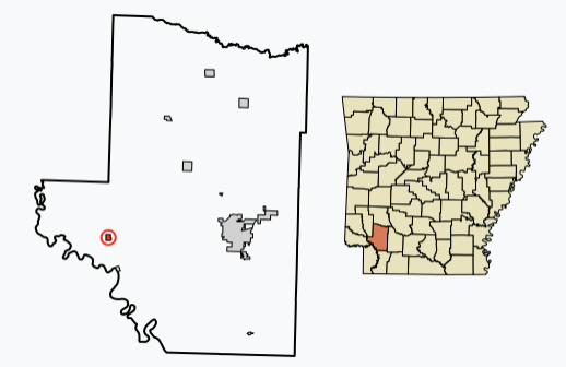
McNab, Ark., and Hempstead County
(Wikipedia map)
McNab, Arkansas, is one of the smallest places that lodged a complaint. The census showed the community went from 68 residents in 2010 to 30 people in 2020. "As a result, the city’s monthly revenue-sharing payment from Arkansas dropped to less than $209 from about $457 last year," Henderson reports. But Mayor James Conway told Henderson that count was wrong; he went door to door and counted 45 people.

Some of the incorrect counts can't be verified door-to-door, but a new tool from the bureau "allows state and local officials to flag errors in counts of people living in institutional settings such as college dorms and prisons. Cities and states have only until April 21 to submit comments on the plan and can submit possible errors for review between June of this year and June 2023," Henderson reports. "The new plan has drawn 34 detailed complaints from cities, states and their advocates, many asking for a way to correct errors that should have been picked up during review processes that were canceled because of the coronavirus pandemic. The new program will help fix institutional counts for future estimates, which the bureau issues annually between its full census each decade. Any corrections won’t, however, affect official counts used for redistricting."

The National Urban League (which sued to stop an early end to the count) is calling for a thorough review that includes more than institutions. Senior 2020 census adviser Jeri Green told Henderson that the bureau "should not place all the burden of getting the count right on elected officials, many of whom don’t have the resources or technical capabilities to challenge their count."

Wednesday, March 02, 2022

Analysis of census data shows Vermont has highest proportion of same-sex couples; how does your state rank?

Proportion of LGBTQ population by state
(Gallup map; click the image to enlarge it or click here for the interactive version)

The state with the highest ratio of same-sex couples is Vermont, one of the most rural states, and it "has the seventh-highest rate of LGBTQ people in the nation, according to a survey analysis from the Williams Institute" at UCLA, Erin Petenko reports for VTDigger. She notes a recent report that the number of people identifying themselves as LGBTQ is rising nationwide: "About 7 percent of adults said they considered themselves to be lesbian, gay, bisexual, transgender or something 'other than heterosexual' in 2021, compared to 3.5% of respondents in 2012, according to Gallup."

Data on the LGBTQ+ population has been difficult to pin down. The 2020 decennial census was the first to collect data on same-sex couples, Petenko reports.

The District of Columbia has the highest overall percentage of LGBTQ people, at 9.8%, but Idaho has the highest percentage of LGBTQ individuals with children, at 44%, according to Gallup.

Tuesday, March 01, 2022

White House council calls one-third of nation's census tracts 'disadvantaged' and thus candidates for more funding

Screenshot: Draft of Climate and Economic Justice Screening Tool (Click image to enlarge or here for interactive version)

"In a significant step toward changing how federal funds are distributed, the Biden administration has preliminarily identified nearly a third of the nation’s census tracts as 'disadvantaged' and in line for more help from the federal government," Kery Murakami reports for Route Fifty.

The White House Council on Environmental Quality identified 23,410 tracts as disadvantaged and noted how each is disadvantaged; you can see the results in the draft of its Climate and Economic Justice Screening Tool. Some are in major metro areas, and some are in "rural areas like Mason County, Washington, which has seen a decline in the timber industry after protections were put in place decades ago to preserve the spotted owl," Murakami reports. "The administration considered a wide range of factors, from the expected loss of agriculture and population due to climate change, to traffic volume and diesel particulate exposure, to the cost of housing, to the rate of asthma, diabetes and heart disease."

If your area isn't listed but you believe it should be, the council has posted a notice in the Federal Register inviting stakeholders to suggest ways to improve the database by April 15, Murakami reports.

Thursday, January 27, 2022

Redistricting could reshape House Agriculture Committee

"At least six members of the House Agriculture Committee face tough reelections under new Ccongressional maps approved by 26 states, while four have plans to leave the House and several more depend on maps that have not yet been approved," Noah Wicks reports for Agri-Pulse. "Under the newly drawn districts, two Illinois Republicans — Mary Miller and Rodney Davis — will battle for control of a seat; Virginia Democrat Abigail Spanberger must navigate her way through a largely unfamiliar district; and Arizona Democrat Tom O'Halleran will need to win the votes of a Republican-leaning constituency. Iowa Democrat Cindy Axne and Nebraska Republican Don Bacon will continue to sit in highly competitive swing districts."

Congressional districts are redrawn after each census to equalize their population. A few states create new maps through independent commissions, but most leave it to state legislatures. "Republicans are counting on redistricting to help them wrest control of the House, which would put [Pennsylvania Rep. Glenn] Thompson in line to become the committee's chairman," Wicks reports. "Democrats currently control the House 221-212, with two vacancies." Agri-Pulse takes a deep dive into how redistricting is playing out for each Agriculture Committee member. Read more here.

Thursday, January 06, 2022

Pandemic may have skewed census recounts; towns that stand to lose funding can request recount starting this week

Some communities are complaining that they will lose state and federal funding because the pandemic skewed their decennial census counts. Nelsonville, Ohio, faced a host of issues: "Renters and older people who were hard to reach, college students who left town during the pandemic and widespread distrust of government questions," Tim Henderson reports for Stateline. "The initial results showed that Nelsonville’s population had dropped below 5,000, which under Ohio law would have made it a village instead of a city. The change in status might have cost it millions of matching state and federal dollars for water, sewer and road projects granted under a program exclusively for small cities. It also hurt Nelsonville’s pride."

Community leaders were approved for a recount, and in October "mounted a whirlwind 10-day volunteer effort, with hundreds of people gathering names at parks and churches and going door to door to find missing addresses. The revised tally was 5,373 residents, and Ohio certified the count, preserving Nelsonville’s city status," Henderson reports. "Many communities across the country argue that pandemic-related chaos made it impossible for census workers to get an accurate count of their populations. But unlike Nelsonville, which benefited from Ohio’s unusually flexible recount law, they are unlikely to get satisfaction from federal officials. As a result, they could miss out on state and federal aid tied to population."

Starting this week, communities that think they were undercounted can file a challenge with the U.S. Census Bureau, but the process only allows challenges on the grounds that people were mistakenly placed outside of city limits. Also, "In an acknowledgement of pandemic-related disruptions, the census bureau recently announced it would review its count of people living in institutions such as college dormitories, prisons and nursing homes," Henderson reports. "But cities and the organizations supporting them want the bureau to expand that review to include apartment buildings."

Wednesday, November 17, 2021

Center of U.S. population is still moving west and south, but not as fast as in recent decades; still in rural Missouri

"Westward movement" has been a feature of America since the first permanent settlements by Europeans, and each time a census is taken, the Census Bureau calculates the center of population, which it says is "a point at where an imaginary, flat, weightless and rigid map of the United States would balance perfectly if everyone were of identical weight." With every census, it has been farther west, but in recent decades it has also headed south. In the last decade, it still headed southwest, but didn't go as far.

The bureau says the center of population is at 37.415725 degrees north latitude and 92.346525 degrees west longitude, just southwest of County Road 303 in Wright County, Missouri, on the waters of Beaver Creek (one of the nation's most common stream names). That's about 15 miles northeast of Hartville, population 613 and the county seat.

"Towns in Missouri have been the population centers since 1980," the bureau says. "The largest movements by miles were between 1850 and 1890, when events like the Gold Rush in California and land speculation in Oklahoma helped spread people farther west." Ron Jarmin, the bureau’s acting director, said “The movement of the center of population helps tell the story of this century’s migration South and West. It helps visualize where we live.”

Google map pinpoints the population center of the U.S. on Census Day, April 1, 2020

The Census bureau also plots the population centers of states, counties, census blocks and census tracts. Where is your state's center of population? The bureau has tracked it since 1880; look here.